
- Account
-
- NEW ARRIVALS
- Men
-

Core Climbing Apparel from prAna
Shop Now »
- Women
-

Patagonia Offers Versatility and Comfort for all your Adventures
Browse Patagonia »
- Kids
- Gear
- Snow Sports
-
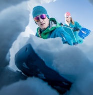
Stay Safe in the Backcountry
Shop Ortovox»
- Paddle Sports
-
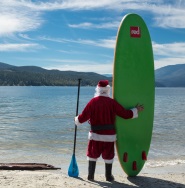
Santa Knows How to Enjoy His Off-Season
Shop Red Paddle »
- DEALS
This Columbia Icefield Map features detailed cartography, accurate hiking trails with distances, and details such as glacier flow direction and drainage routes. Campgrounds and highway viewpoints are also marked.
In addition to the map, this product is a user-friendly guide to the Columbia Icefield. It includes detailed descriptions of what to see and do at the icefield, recommended hiking trails, a wildlife-viewing guide, answers to frequently asked questions (How big is the Columbia Icefield? How deep is the ice? Why is the glacial ice blue? And many more), and a list of the highest surrounding mountains.
Columbia Icefield Map Coverage:
Our Columbia Icefield Map covers the entire Columbia Icefield, which lies at the southern end of Jasper National Park, straddling the provincial border dividing Alberta and British Columbia. It also extends north to Beauty Creek and the Brazeau Loop Trail (southern section only) and south to Castleguard Mountain.
Popular hiking trails on the Columbia Icefield Map include Stanley Falls, Wilcox Pass, Toe of the Glacier, Parker Ridge, and Nigel Pass.
Updated for 2021 with satellite imaging showing current glacial extents, Gem Trek’s COLUMBIA ICEFIELD MAP is designed for hikers and outdoor enthusiasts looking to explore North America’s largest icefield south of Alaska. Located beside the Icefields Parkway, the Columbia Icefield is both spectacular and accessible. Whether you are touring along the parkway and taking an Ice Explorer out onto the Athabasca Glacier or heading off to explore the surrounding wilderness on foot, you’ll find our waterproof and tear-resistant Columbia Icefield Map an invaluable tool for making the most of your visit.
This Columbia Icefield Map features detailed cartography, accurate hiking trails with distances, and details such as glacier flow direction and drainage routes. Campgrounds and highway viewpoints are also marked.
In addition to the map, this product is a user-friendly guide to the Columbia Icefield. It includes detailed descriptions of what to see and do at the icefield, recommended hiking trails, a wildlife-viewing guide, answers to frequently asked questions (How big is the Columbia Icefield? How deep is the ice? Why is the glacial ice blue? And many more), and a list of the highest surrounding mountains.
Columbia Icefield Map Coverage:
Our Columbia Icefield Map covers the entire Columbia Icefield, which lies at the southern end of Jasper National Park, straddling the provincial border dividing Alberta and British Columbia. It also extends north to Beauty Creek and the Brazeau Loop Trail (southern section only) and south to Castleguard Mountain.
Popular hiking trails on the Columbia Icefield Map include Stanley Falls, Wilcox Pass, Toe of the Glacier, Parker Ridge, and Nigel Pass.
* ISBN: 978-1-895526-96-7
* Scale: 1:75,000
* Edition: 6th, 2020
* Folded size: 4.5 x 9.5 in
* Flat size: 19 x 35 in
The Columbia Icefield Map includes:
* Waterproof and tear-resistant paper
* Contour lines at 60-metre (200-foot) intervals
* Relief shading to better show the topography
* Full colour on both sides
* Hiking trails - with trail names and trail distances marked
* Hydrology – rivers, glaciers, and waterfalls
* Mountain names and all available mountain elevations
* All campgrounds
* Points of interest and attractions
* Picnic areas
* Highway viewpoints

How Adventure Bucks Work
Earn Adventure Bucks every time you make a purchase*! Even 'on sale' items, in-store or online at VPO.ca. Each Adventure Buck is worth $1, so figure out what you want to buy!
You can redeem your Adventure Bucks at anytime:
- InStore: Ask the staff to apply your Bucks to your purchase.
- Online: Enter the amount of Bucks you wish to redeem in the Payment tab to apply them to your online order.
- *Arc'teryx items are excluded
Shipping Information
We Ship Anywhere Within Canada
Signature Required & Faster Shipping Options
All parcels are shipped ground with a signature required. If you want your order quicker, give us a call at 1-800-SHOP-VPO for a quote. Prices are in Canadian dollars. We will ship your order via Purolator Ground or Canada Post Regular Parcel . If you prefer one method over another, please make note in the notes/delivery instructions when you checkout.
Free Shipping
FREE shipping on orders totaling $49 or more before taxes.
NOTICE: THIS ITEM WILL BE DELAYED BY 5-12 BUSINESS DAYS.
| Destination | Estimated Arrival |
| Western Canada | 5-15 business days |
| Central Canada | 7-17 business days |
| Eastern Canada | 9-21 business days |
* We use Purolator for majority of our shipments. If you live in a rural area, Northern Canada, the Maritimes, or we have to use Canada Post for delivery, please note that the estimated arrival time may be longer.
Oversized or Overweight Item
This item is subject to a shipping surcharge
Unfortunately due to the size or weight of this item, we are required to apply a shipping surcharge when you order this item. To read our full shipping and freight policy, please click here.
Sorry, the real-time inventory lookup is not available at this time.
Sorry, the colour and size you selected is not available.
Colour & size selection available at: